


EATON - T 2 Voting District, Brown County, Wisconsin
About
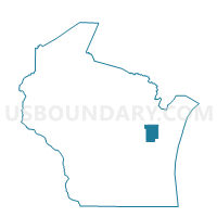
Outline

Summary
| Unique Area Identifier | 692425 |
| Name | EATON - T 2 Voting District |
| County | Brown County |
| State | Wisconsin |
| Area (square miles) | 10.11 |
| Land Area (square miles) | 9.94 |
| Water Area (square miles) | 0.17 |
| % of Land Area | 98.34 |
| % of Water Area | 1.66 |
| Latitude of the Internal Point | 44.44465960 |
| Longtitude of the Internal Point | -87.86289620 |
Maps


Graphs
Select a template below for downloading or customizing gragh for EATON - T 2 Voting District, Brown County, Wisconsin


Neighbors
Neighoring Voting District (by Name) Neighboring Voting District on the Map
- BELLEVUE - T 10 Voting District, Brown County, WI
- EATON - T 1 Voting District, Brown County, WI
- GLENMORE - T 1 Voting District, Brown County, WI
- Green Bay - C 5 Voting District, Brown County, WI
- HUMBOLDT - T 2 Voting District, Brown County, WI
- LEDGEVIEW - T 1 Voting District, Brown County, WI
- NEW DENMARK - T 2 Voting District, Brown County, WI
Top 10 Neighboring County Subdivision (by Population) Neighboring County Subdivision on the Map
- Green Bay city, Brown County, WI (104,057)
- Bellevue village, Brown County, WI (14,570)
- Ledgeview town, Brown County, WI (6,555)
- New Denmark town, Brown County, WI (1,541)
- Eaton town, Brown County, WI (1,508)
- Humboldt town, Brown County, WI (1,311)
- Glenmore town, Brown County, WI (1,135)
Top 10 Neighboring Place (by Population) Neighboring Place on the Map
Top 10 Neighboring Unified School District (by Population) Neighboring Unified School District on the Map
- Green Bay Area School District, WI (136,070)
- Luxemburg-Casco School District, WI (11,083)
- Denmark School District, WI (8,356)
Top 10 Neighboring State Legislative District Lower Chamber (by Population) Neighboring State Legislative District Lower Chamber on the Map
Top 10 Neighboring State Legislative District Upper Chamber (by Population) Neighboring State Legislative District Upper Chamber on the Map
Top 10 Neighboring 111th Congressional District (by Population) Neighboring 111th Congressional District on the Map
Top 10 Neighboring Census Tract (by Population) Neighboring Census Tract on the Map
- Census Tract 207.03, Brown County, WI (6,963)
- Census Tract 207.02, Brown County, WI (5,884)
- Census Tract 201, Brown County, WI (5,645)
- Census Tract 206, Brown County, WI (5,172)
- Census Tract 20.03, Brown County, WI (3,278)